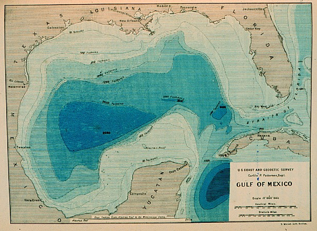
Bathymetric maps are a type of contour map that use isolines to portray sea floor elevation. Similarly to how the spacing contour lines represents the grade of a slope on a mountain on a topographic map, the same principal is applied to ocean depth in the opposite direction. Above is one of the first bathymetric maps to even somewhat accurately portray any ocean basin. The basin in the map displayed is the Gulf of Mexico between the years 1873- 1875.
http://celebrating200years.noaa.gov/events/survey/gulf_of_mexico.html
No comments:
Post a Comment